September 30, 2022 by Nihanth Cherukuru
Visualizing wildfire data using VAPOR
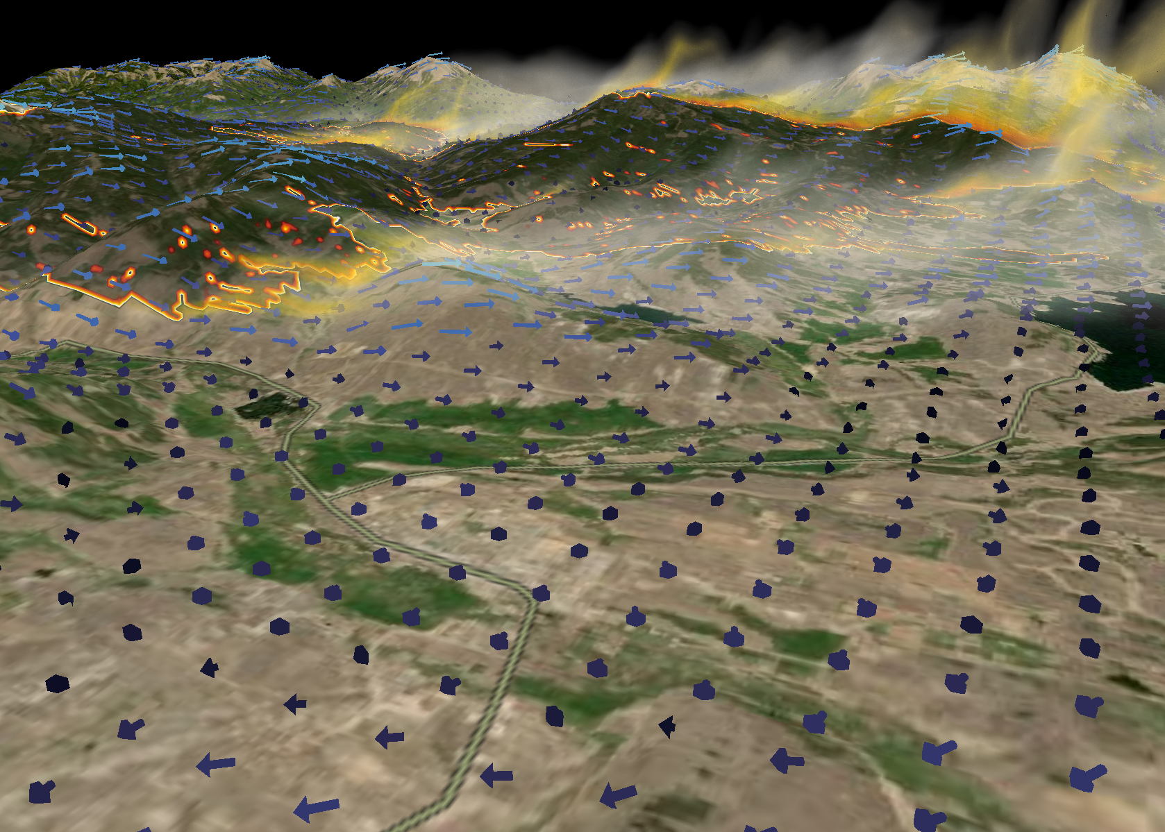
On October 14, 2020, the East Troublesome Wildfire ignited. It burnt 193,812 acres over the course of 48 days. Between October 20-23 the wildfire rapidly intensified, exploding from 18,550 acres to 187,964 acres in size. This visualization created by Scott Pearse from ViSR in collaboration with scientists from NCAR/RAL and Northern Arizona School of Forestry show a Weather Research & Forecasting (WRF) simulation of the East Troublesome Wildfire from the perspective of Granby, Colorado. It uses a physics module (WRF-Fire) that incorporates an AI driven model for combustable plant matter known as Beetle Kill. Visit this link to watch Scott’s presentation on the use of VAPOR for wildfire research