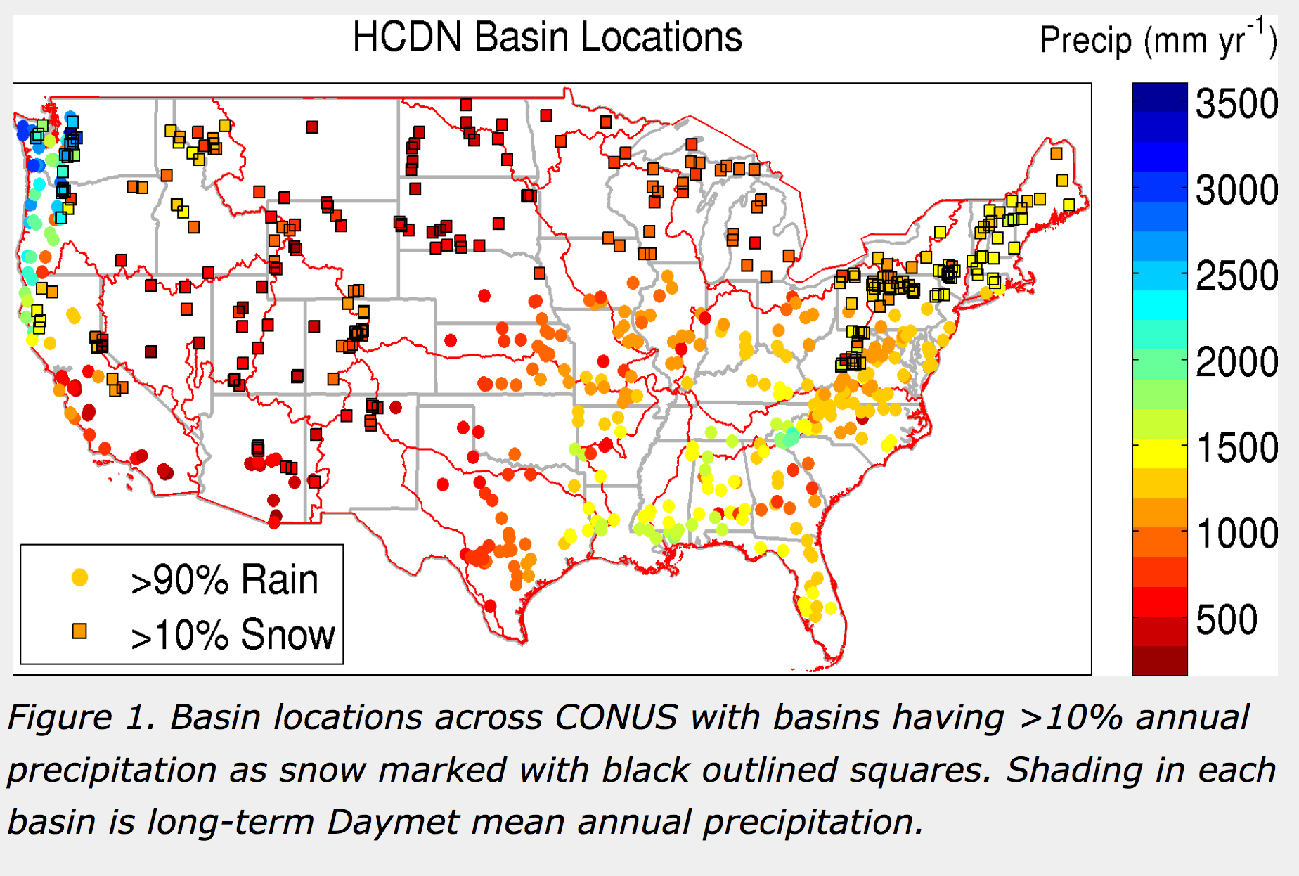
This project developed basin scale hydrometeorological forcing data for 671 basins in the United States Geological Survey’s Hydro-Climatic Data Network 2009 (HCDN-2009, Lins 2012) conterminous U.S. basin subset. Retrospective model forcings are derived from Daymet, NLDAS, and Maurer et al. (2002) Daymet and NLDAS forcing data run from 1 Jan 1980 to 31 Dec 2014, and Maurer run from 1 January 1980 to 31 December 2008. Model timeseries output is available for the same time periods as the forcing data. USGS streamflow data are also provided for all basins for all dates available in the 1 Jan to 31 Dec 2014 period. Figure 1 displays the location of each basin with the mean annual precipitation (mm) colored. State boundaries are in gray and the USGS HUC level 02 regions are in red.
Following generation of the forcing data, we initially implemented the hydrologic model and calibration routine traditionally used by the NWS, the SNOW-17 and Sacramento soil moisture accounting (SAC-SMA) based hydrologic modeling system and the shuffled complex evolution (SCE) optimization approach (Duan et al. 1993).
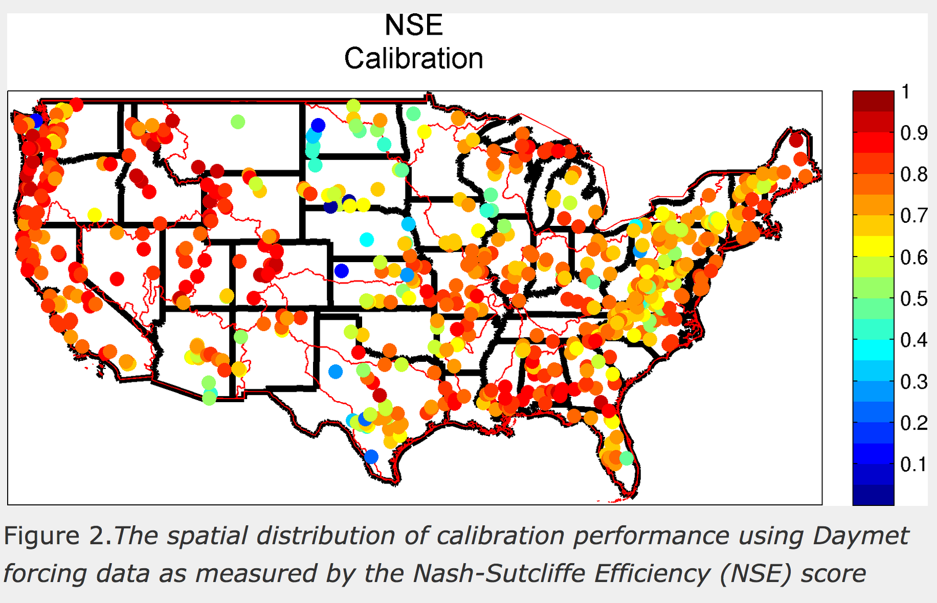
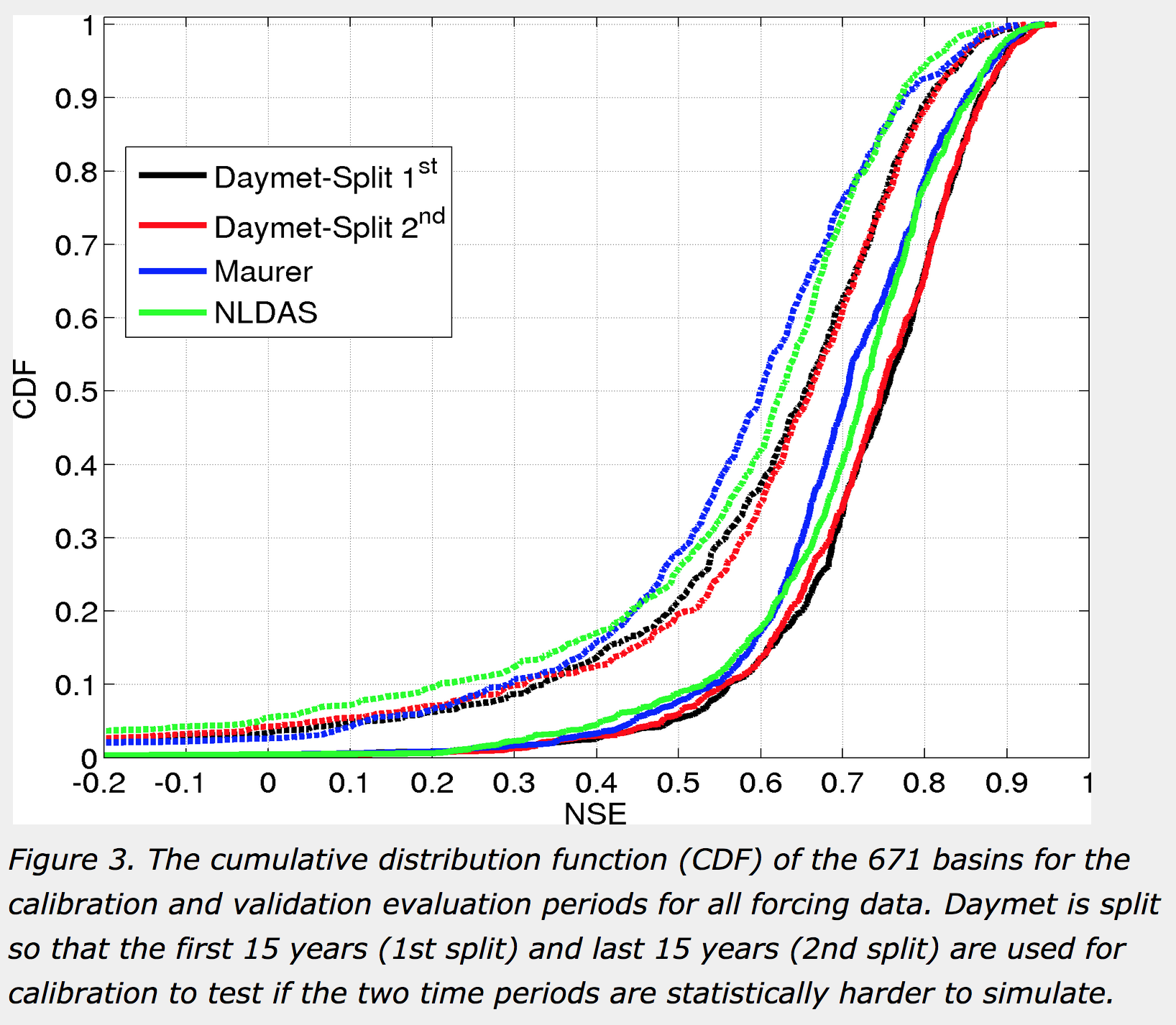
Results indicate that the SNOW-17/SAC-SMA optimized model parameters perform quite well overall (Figures 2 and 3), with arid basins and basins along the high plains of the US generally having worse model performance (Fig 2).
Finally, we have packaged all the basin metadata (shapefiles, locations, etc), hydrometeorological forcing data, streamflow data, model summary statistics, raw model output and model parameters in a large-sample basin scale hydrometeorolgical dataset that can be downloaded using the link at the top of the page.
Release date: 2014, last updated March 2016
Versions: 1.2, available
Access information: freely available at https://ral.ucar.edu/solutions/products/camels
How to cite this resource:
Format/size: ascii files, 15 GB compressed, roughly 130 GB uncompressed
Coverage: 671 watersheds across contiguous USA
Dataset details: Newman et al., HESS, 2015
NCAR: Martyn Clark (PI), Andrew Newman, Kevin Sampson
USGS: A. Bock, R.J. Viger, D. Blodgett
Contact: Andrew Newman | anewman@ucar.edu
Bureau of Reclamation, U.S. Army Corps of Engineers
Related datasets: CAMELS_attributes
Related Papers:
3450 Mitchell Ln
Boulder, Colorado 80301
United States