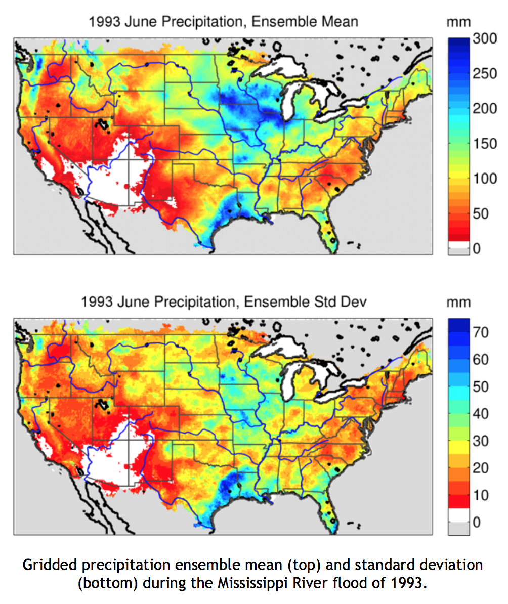
Development of the Gridded Meteorological Ensemble Tool (GMET) allows for quantification of uncertainty for station-based gridded precipitation and temperature datasets, specifically:
GMET completes the many steps needed to construct gridded meteorological ensembles: (1) ingests station data (current simulations draw from over 12,000 unique stations), (2) ensures stations are serially complete (rejects records too short to be validated and fills data gaps using well-established methods), (3) interpolates the serially-complete precipitation and temperature time series from station data to estimate the probability of precipitation occurrence and probability distributions of precipitation amounts, and (4) generates ensemble gridded spatial fields using spatially and temporally correlated random fields to sample from estimated distributions generated in the earlier step, which allows for consistent estimates of uncertainty in both space and time. The probabilistic interpolation approach is detailed in Clark and Slater [2006].
GMET has been used to develop a first-of-its-kind ensemble dataset of daily precipitation and temperature at one-eighth degree spatial resolution for the contiguous United States from 1980 to 2012. The 100-member ensemble dataset, described in Newman et al. [2015], compares well with established data products, reflects observational and interpolation uncertainty, and is freely available at: http://dx. doi.org/10.5065/D6TH8JR2.
GMET produced ensembles have been used in hydrologic data assimilation (e.g., to evaluate the potential for snow data assimilation to improve seasonal streamflow prediction across the western US) and high-resolution regional climate model evaluation.

NCAR: Martyn Clark (PI), Andrew Newman, Andy Wood, Ethan Gutmann
U.S. Army Corps of Engineers: Jeff Arnold
Bureau of Reclamation: Levi Brekke
Contact: Andy Newman - anewman@ucar.edu | Julie Vano - jvano@ucar.edu
U.S. Army Corps of Engineers, Bureau of Reclamation
Project information: meteorological_datasets
Papers:
Datasets: