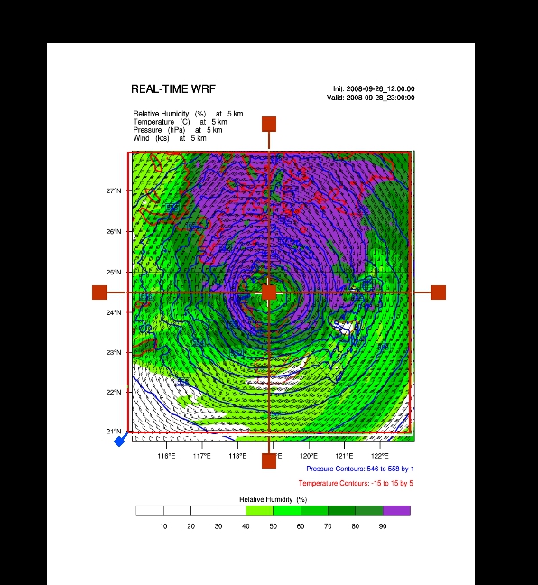
I am a new user of VAPOR and I'm trying to crop an image of NCL to use in a georeferenced map used. I use NCL version 6.2.0, and Vapor 2.4.0.RC0-Linux_x86_64/Vapor 2.3.0-Linux_x86_x64 with the example wrf_Height_Final.ncl. I changed to True the followind command: wrf2geotiff_write(wrf2gtiff, a, times(it), wks, plot, False), and don't crop corretly.
Domain size are:
Time = UNLIMITED ; // (48 currently)
DateStrLen = 19 ;
west_east = 649 ;
south_north = 399 ;
bottom_top = 29 ;
bottom_top_stag = 30 ;
soil_layers_stag = 4 ;
west_east_stag = 650 ;
south_north_stag = 400 ;
Image cropped:


Please try this with Vapor 2.4.0 RC0 . The crop problem was fixed, although it might still be slightly off.
-Alan
Sorry if I misunderstood your post. Did you mean that you tried with both Vapor2.3.0 and with Vapor2.4.0RC0 ? Was the the cropping error the same in both? Which version of vapor was used for the image you posted?
Thanks,
-Alan
Would you please repeat running this ncl script but do it on the jangmi data (which you can download from the vapor website)? When I use vapor 2.4.0 there is only a slight (but significant) mismatch (about a 1% error in the vertical alignment). If you can point me to your HurricaneIKE data I will try this on that data to see if the misalignment is greater.
Thanks,
-Alan
I have attached an image that uses wrf2geotiff.ncl, showing the error in the crop position using the jangmi data. It's about a 4% error in the vertical. Is this comparable to the error you are seeing?
-Alan
Thanks for posting those images. We are expecting a new release of NCL in about a month, and it will include a more accurate georeferencing/cropping capability. We should also have another release of VAPOR soon; together these changes should resolve the cropping issues you are having.
Regards,
-Alan
Thanks.