NASA AIST

Advancing Technology Readiness to Address Climate Risks in the Water Sector

The challenge:

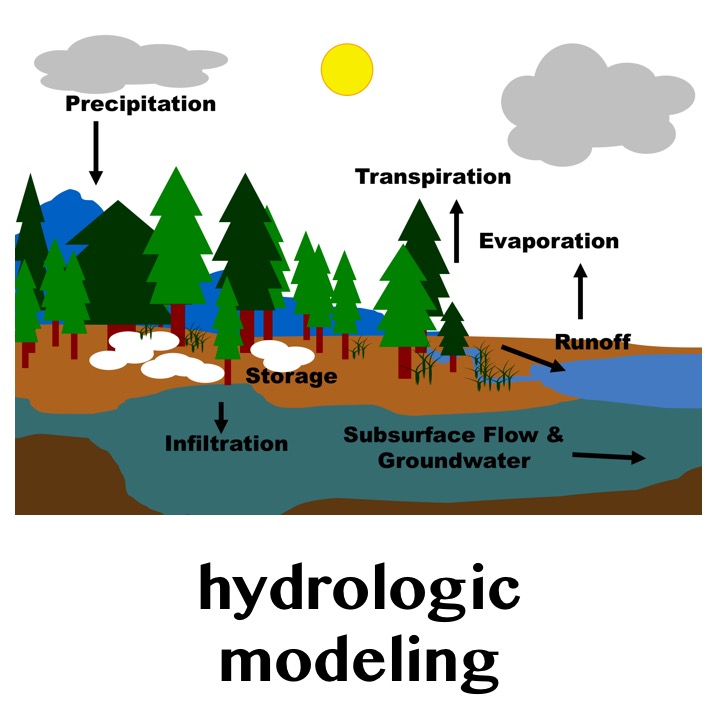
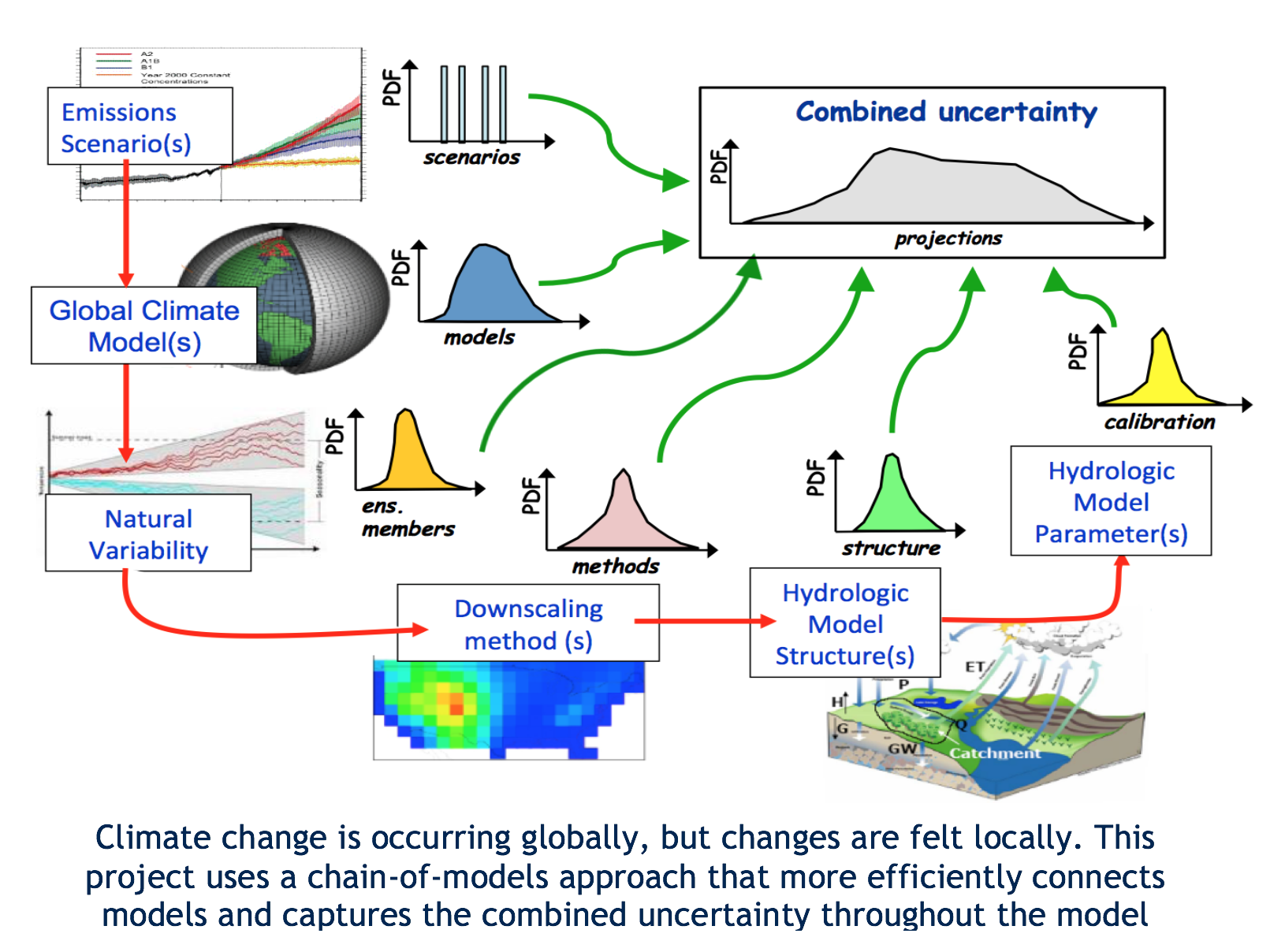
The research community has made substantial scientific advances in understanding impacts of climate variability and change on water resource systems; however, the opportunities exist to improve the technical readiness and usability of climate downscaling and hydrologic modeling science to support adaptive water resources planning. The goal of this project is to increase the value of emerging science advances in climate downscaling and hydrologic modeling for water resources planning and management.

Facing this challenge:

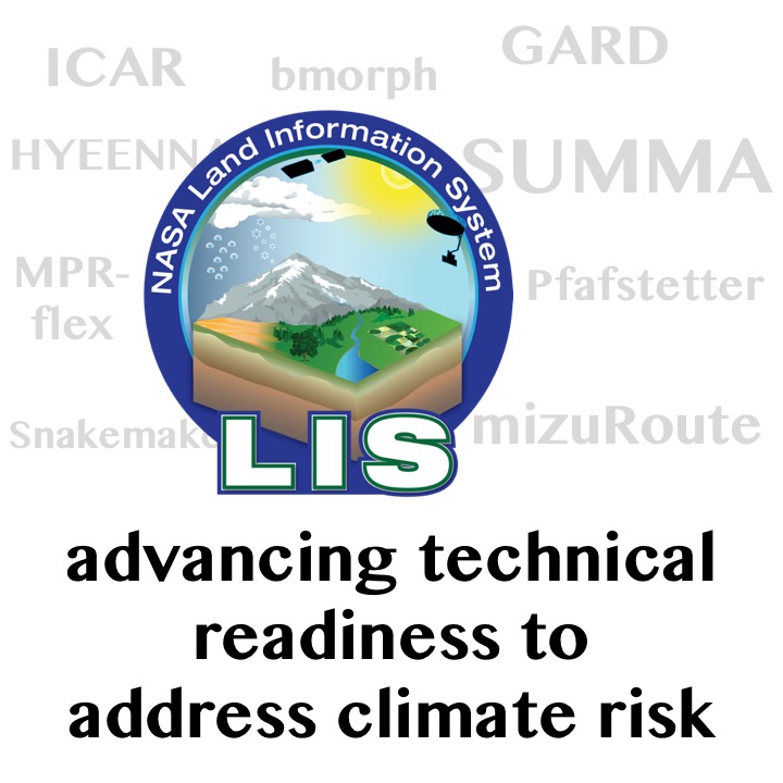
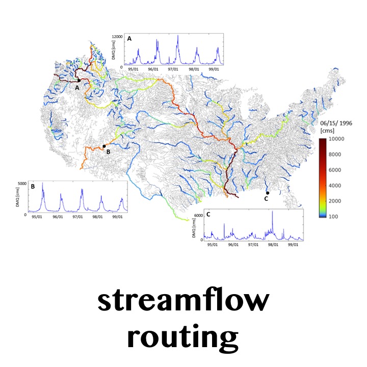
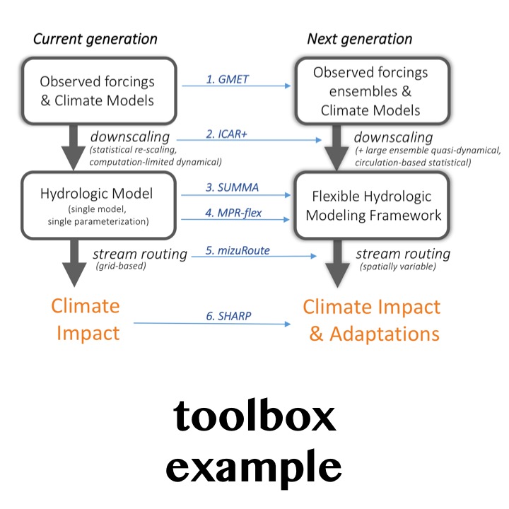
Scientists and engineers in RAL’s Hydrometeorological Applications Program at the National Center for Atmospheric Research are collaborating with NASA Goddard Space Flight Center and partners at three universities (U. of Washington, U. of Alabama, and U. of Saskatchewan) to develop more computationally efficient tools and data resources for both researchers and practitioners. With funding from NASA’s Advanced Information System Technology program, the team is working to increase the readiness of emerging technologies and science through extending capabilities of the NASA Land Information System (LIS). LIS currently provides a software framework for high performance terrestrial hydrology modeling and data assimilation used by interagency partners. This project adds a suite of modeling LIS-compatible tools and datasets that enhance its ability to evaluate future climate change impacts on water systems.

Technology advances:

Specific work elements underway include:

  • Advance climate downscaling tools. Extend statistical and downscaling techniques of ICAR and GARD to provide climate change scenarios as input to LIS.
  • Extend and refine hydrologic modeling capacities in LIS. Incorporate a new hydrologic modeling framework, the Structure for Unifying Multiple Modeling Alternatives (SUMMA), the mizuRoute streamflow routing scheme to enable more flexible evaluation of future streamflow.
  • Tailor model output to increase applicability. Engage practitioners in the water management community throughout the project to design guidance and tools relevant to water planners and managers.
  • Employ information theory and machine learning. Navigate modeling options and guide future investment priorities by applying advanced concepts of information theory and machine learning which leverage process-level tradeoffs, uncertainty decomposition, and network analysis.

Moving Forward:

  • Improvements in modeling and workflow tools have improved the reproducibility and transferability of complicated downscaling and land surface modeling and analysis systems.
  • Parallelization has enabled simulations to run ~1000 times faster, and improved sub-setting capabilities now support more high-resolution spatial information.
  • A new flexible modeling framework will expand applicability of LIS to varied Earth system modeling contexts.
  • LIS-compatible future climate inputs and simulations will enhance use of LIS to project future water resources.

Project Team

NCAR: Andy Wood (PI), Ethan Gutmann (Co-I), Naoki Mizukami, Joe Hamman, Julie Vano

NASA Goddard: Christa Peters-Lidard (Co-I), Sujay Kumar, Kristine Verdin, James Geiger, Scott Rheingrover

University of Washington: Bart Nijssen (Co-I), Andrew Bennett

University of Alabama: Grey Nearing

University of Saskatchewan: Martyn Clark

Contact: Andy Wood - andywood at ucar.edu | Julie Vano – jvano at ucar.edu

Project Sponsors

NASA's Advanced Information System Technology program

More Information


Model information:

       SUMMA

       ICAR

       mizuRoute

       LIS

Factsheets:  

        2-Pager (same info as this page)

Papers:

    Mizukami, N., M.P. Clark, K. Sampson, B. Nijssen, Y. Mao, H. McMillan, R.J. Viger, S.L. Markstrom, L.E. Hay, R. Woods, J.R. Arnold, and L.D. Brekke, 2016: mizuRoute version 1: a river network routing tool for a continental domain water resources applications. Geoscientific Model Development, 9, 2223-2238, doi:10.5194/gmd-9-2223-2016
 
    Gutmann, E., I. Barstad, M.P. Clark, J. Arnold, and R. Rasmussen, 2016: The Intermediate Complexity Atmospheric Research Model. Journal of Hydrometeorology, 17, 957–973, doi:10.1175/JHM-D-15-0155.1
 
    Clark, M.P., B. Nijssen, J.D. Lundquist, D. Kavetski, D.E. Rupp, R.A. Woods, J.E. Freer, E.D. Gutmann, A.W. Wood, L.D. Brekke, J.R. Arnold, D.J. Gochis, and R.M. Rasmussen, 2015: A unified approach to process-based hydrologic modeling. Part 1: Modeling concept. Water Resources Research, 51, 2498–2514, doi:10.1002/2015WR017198
 
    Peters-Lidard, C.D., P.R. Houser, Y. Tian, S.V. Kumar, J. Geiger, S. Olden, L. Lighty, B. Doty, P. Dirmeyer, J. Adams, K. Mitchell, E.F. Wood and J. Sheffield, 2007: High-performance Earth system modeling with NASA/GSFC's Land Information System. Innovations in Systems and Software Engineering, 3(3), 156-165, doi:10.1007/s11334-007-0028-x
 

Related Work

NASA AIST

DOS and DON'TS

Sub-seasonal to Seasonal

Hydrologic Modeling

Streamflow Forecasting

Hydrologic storylines for evaluating climate impacts

Intermediate-Complexity Downscaling

Ensemble Meteorological Datasets

Streamflow Routing

Toolbox

address

3450 Mitchell Ln
Boulder, Colorado 80301
United States