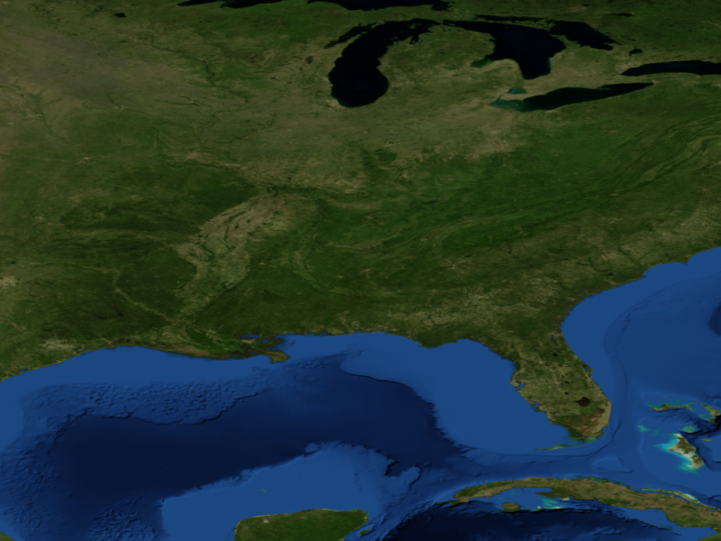
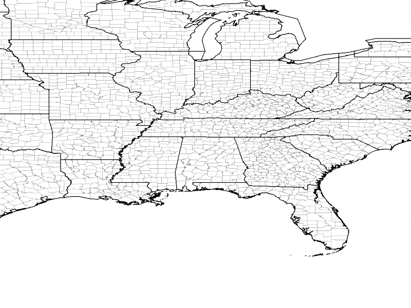
VAPOR 2.1 and later versions provide pre-installed terrain and political boundary images of the entire world, that can be visualized with your data. Therefore it is not necessary for you to perform this step. However, sometimes it may be useful to retrieve an image of your own choosing to apply in the VAPOR scene. Therefore we provide this optional step of retrieving geo-referenced images.
We shall use the shell script "getWMSImage.sh" to obtain the following two images, which will enable geo-referencing in the scene:
We will place the 2nd image above the first image. When we see these in 3D we can view the two images together as if they were a single terrain image, with political boundaries superimposed.
All the Katrina d02 data (from 8/29/2006 to 8/31/2006) fits inside a longitude/latitude rectangle that goes from (-97,20) to (-77,45). This can be ascertained by examining the XLAT and XLON variables in the data. This information is also provided in the output of the wrfvdfcreate command. Also, if you read your data into vaporgui, you can see the lon/lat extents at each time step, by looking at the bottom of the Region panel and choosing various time steps in the dataset.
The getWMSImage.sh command has several options that can be seen by issuing the command "man getWMSImage". For the first image we need only specify the file name and the latitude/longitude extents. We use (-97,20) and (-77,47) to define the image extents, and all of the d02 domains will lie within these extents.
Make sure that you have internet access from your computer, for this image will be retrieved from a Web mapping service. In the same directory where the Katrina.vdf file is located, issue the command:
getWMSImage.sh -o katrinaTerrain.tiff -97 20 -77 47
After a few seconds the following image (in the file KatrinaTerrain.tiff) will be retrieved:

Note that this image is more than simply an array of colored pixels. This is a geoTiff file, i.e. a TIFF image with additional geo-referencing information so that it can be correctly mapped to the earth's surface.
To obtain the state/county boundary image we must specify in addition the following options:
-t (indicates the image will be transparent)
-m UScounties (indicates the US county boundary map)
-o KatrinaCounties.tiff (indicates the name of the file)
Issue the command:
getWMSImage.sh -o katrinaCounties.tiff -m UScounties -t -97 20 -77 47
to obtain the following image:

The white portions of the above image are actually transparent. The county image will be superimposed over the terrain image to provide a geographical context for the visualization.